Another monstrous earthquake triggers tsunami in Indonesia, killing up to 2,000
Thousands of local residents poured out into streets over the fear of imminent earth tremors
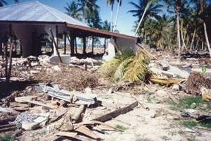
Another natural disaster rocked the shores of Indonesia on Monday night. A powerful earthquake hit the island of Nias, having killed up to 2,000 people.  The epicenter of the quake was situated in the Indian Ocean, about 90 kilometers off the island. The power of the earthquake was measured 8.7 on the Richter scale. Tidal waves up to three meters high hit the coasts of the Indonesian island of Simeuleu as well, although it was originally reported that the quake did not result in another tsunami. Up to 70 percent of buildings on the island have been leveled with the earthquake, eyewitnesses say. About 10,000 people of the 27,000-strong population of Nias have been left without their homes.
For the time being, local authorities provide different information about the number of victims of the new disaster in Indonesia. Indonesian Vice President Jusuf Kalla said that the numbers of dead could be estimated between 1,000 and 2,000, whereas the country's Healthcare Ministry reported only 300.
Killer tsunami in Southeast Asia - rare photographs
Thousands of local residents poured out into streets over the fear of imminent earth tremors. American, British, Australian and Japanese specialists that are currently observing the seismological situation in the region say that over a dozen of quakes have been registered, measuring from 5 to 6.1 on the Richter scale. The earthquake echoed in neighboring states – Malaysia, Singapore and Thailand.
Despite the relatively small scale of damage, the new earthquake has been added to the top ten list of strongest quakes in the history of seismological observations.
The most powerful earthquake of modern times occurred in 1960 in Chile and in Alaska in 1964. Both of those earthquakes were measured 9.5 on the Richter scale. The list of other strongest tremors includes the earthquake in Ecuador – 8.8 in 1906, in Alaska - 6.7 in 1965, in Tibet – 8.6 in 1950, in Russia's Kamchatka Peninsula – 8.5 in 1923 and in Kuril islands – 8.5 in 1963. All of those natural disasters, however, were limited with the territory of only one country or one region of a country.
The Indonesian region has always been considered seismologically dangerous. The strongest earthquake in the history of Indonesia was registered on February 1st, 1938. Killer tsunamis inundated the shores of Indonesia in 1833 and 1861, having killed tens of thousands of people.
The recent tsunami disaster of December 26th, 2004 became the most devastating natural catastrophe in the history of mankind. The earthquake triggered giant tidal waves, which swept off everything on their way. Monstrous damage was caused to several countries of the region, situated at huge distances from each other – from Indonesia and Malaysia in the east to African states in the west. Up to 300,000 people were killed in the disaster, especially in the west of Sumatra, Sri Lanka, the island of Phucket in Thailand and the south-east of India.
Scientists predicted another earthquake in the region of Indonesia, which could most likely hit the coasts of Sumatra. Seismologists could not say, if it was going to be a new natural catastrophe, although they reminded of dual quakes, which had been registered in 2004. Such earthquakes usually occur several months or even years after an original quake.
It would have been possible to avoid such a huge number of victims in the tsunami disaster, if Indonesia and other states of the region had had professional seismological services and tsunami warning systems. Earthquakes have already become common for Japanese citizens, for example: earth tremors in Japan usually result in minimum number of victims owing to local seismological forecasts.
Unfortunately, the residents of Southeast Asia are destined to learn how to survive the horror of tsunamis and earthquakes with their own efforts only, until a warning system is created in the region.
Subscribe to Pravda.Ru Telegram channel, Facebook, RSS!


