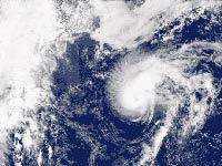
Tropical Storm Lorenzo forms in Mexico's Gulf Coast
Lorenzo made landfall early Friday after strengthening rapidly into a Category 1 hurricane as it bore down on Mexico's Gulf Coast with powerful winds and rain, forcing authorities to evacuate low-lying coastal communities.

The U.S. National Hurricane Center in Miami said the hurricane made landfall along the east-central coast of Mexico, southeast of Tuxpan.
Officials canceled classes and opened more than 60 shelters on the coastline of Veracruz state Thursday, as Mexico's government issued a hurricane warning from Palma Sola to Cabo Rojo.
At least 30 communities near several rivers were ordered to evacuate late Thursday. Residents scrambled to move furniture and belongings to higher ground even as roads began to flood.
"We never expected the hurricane would hit here," said Ribay Peralta, a 33-year-old lawyer who was packing his car with televisions sets, DVD players and other appliances in the town of San Rafael, a low-lying community about 15 kilometers (nine miles) from Veracruz's coast.
"San Rafael is a town that gets flooded easily," he said by telephone.
The U.S. National Hurricane Center had forecast that Lorenzo would strengthen before making landfall, and it warned that "preparations to protect life and property should be rushed to completion."
"The speed with which this storm is developing is forcing us to react as fast as we can," said Ranulfo Marquez, Veracruz's deputy secretary for public safety.
The ports of Tecolutla, Tuxpan and Nautla were ordered to close by midnight, Veracruz's port authority said.
The mountain ranges and river areas in the Gulf state of Veracruz are dotted with villages connected by precarious roads and susceptible to disaster. Hurricane Dean brought widespread flooding to the area in August, and in 1999 a rainstorm caused floods that killed at least 350 people.
At 0600GMT, Lorenzo was centered about 65 kilometers (40 miles) east-southeast of Tuxpan and was moving westward at 13 kph (8 mph), the Florida-based center said. It had top sustained winds near 130 kph (80 mph).
The storm was expected to slam ashore with "dangerous and battering waves" as well as storm surge flooding of half a meter to 1.2 meters (2 to 4 feet), the center said.
Forecasters said the slow-moving Lorenzo could dump 13 to 25 centimeters (5 to 10 inches) of rain in Veracruz, with isolated downpours reaching 38 centimeters (15 inches).
Mexico's Interior Secretary warned of mudslides in at least four states and said port activity in the Gulf Coast states of Veracruz and Tamaulipas would be suspended.
Lorenzo was expected to weaken rapidly after making landfall.
Meanwhile, Tropical Storm Karen weakened slightly in the open Atlantic Ocean.
Karen's center was about 1,250 kilometers (780 miles) east of the Windward Islands at 0300GMT and moving northwest near 22 kph (14 mph). Its maximum sustained winds had decreased from 104 kph to 97 kph (65 mph to 60 mph).
The center forecast that the disorganized storm would continue to lose strength in the near term, but said it could then regain force and become a hurricane in five days.
Subscribe to Pravda.Ru Telegram channel, Facebook, RSS!


