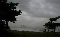
Ernesto to flood North Carolina
Tropical Storm Ernesto slogged into North Carolina, capping a day of heavy rain in the eastern part of the state and promising more of the same as it moved north early Friday.

See the photo report of Ernesto's destruction
But the system stayed just short of hurricane strength, and though forecasters issued numerous warnings, Ernesto brought no major flooding, few evacuations and no confirmed tornadoes by the time it made landfall and moved inland.
Ernesto was expected to weaken to a tropical depression as it moved further inland later Friday.
After the center of the storm blew through Kinston, about 75 miles (120 kilometers) north of Wilmington, one resident said there was some street flooding, but not a lot more.
"It's about quit raining," said Johnny Smith, manager of a sporting goods store. "We're looking pretty good right now."
Flood warnings and watches were issued across mostly rural eastern North Carolina, and a tornado watch extended across central-eastern counties and along the Outer Banks.
"The biggest concern is flooded roads - especially at night, it's harder to tell if a road has been washed out or not," state spokeswoman Patty McQuillan said early Friday. "If people don't need to drive, they shouldn't be out there."
Continuing rainfall was expected to push the Tar and Neuse rivers over their banks in several eastern towns, she said.
In Beaufort County, a mandatory evacuation was issued for about 1,500 families, said George Sullivan, director of the county Emergency Management Office.
Nearly 300 people remained Friday morning in one of the 18 shelters the state opened in 13 counties, primarily in the eastern third of the state.
Ernesto's sustained winds reached 70 mph (112 kph), just 4 mph (6.5 kph) below hurricane strength, as it made landfall at Long Beach, just west of Cape Fear, at 11:30 p.m. Thursday (0330 GMT Friday). It dumped more than 8 inches (20 centimeters) of rain on the Wilmington area - a record for Aug. 31, according to the National Weather Service.
The storm weakened as it moved inland. At 8 a.m. (1200 GMT) Friday, Ernesto was moving north at about 15 mph (24 kph) with maximum sustained winds of nearly 50 mph (80 kph), the weather service said. The storm center was just east-southeast of Rocky Mount, North Carolina, and about 100 miles (160 kilometers) southwest of Norfolk, Virginia.
Even in a state that has seen widespread drought this summer, many feared the rain might be too much of a good thing. A separate storm system had already dropped as much as 8 inches (20 centimeters) of rain on parts of central and eastern North Carolina on Wednesday.
"We need some rain around here - just not all at once," said Jean Evans, a convenience store worker on North Carolina's Holden Beach.
A hurricane watch was canceled early Friday from the South Santee River in South Carolina to Cape Lookout, about 50 miles (80 kilometers) east of Jacksonville, while a tropical storm watch was posted from Cape Fear to Currituck Beach, including Pamlico and Albemarle sounds.
The storm was expected to take a slightly curved track through eastern North Carolina overnight and cross into Virginia during the day Friday, skirting Washington, D.C., late Friday or early Saturday.
Sean Gainer was driving down a street in Wilmington when his car suddenly stalled in two feet (60 centimeters) of water. By the time he and others pushed it to safety, the water in the road had receded, the AP reports.
"I've driven in hurricanes and I've seen worse than this. That kind of luck just happens," he said.
Subscribe to Pravda.Ru Telegram channel, Facebook, RSS!


